
Nearby Swimming Holes
Sightseeing
20 min (20.9 km) via Trans-Canada Hwy/BC-1 S
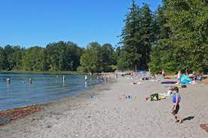
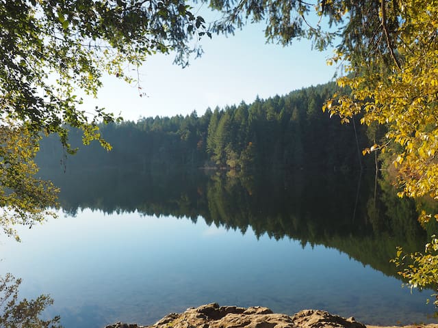
Because of its proximity to downtown Victoria, Thetis can get quite busy on a hot summer’s day. There are two sandy beaches (one at the southernmost tip of the lake and one a little further up on the west side) but they both become crowded quite quickly. Luckily, there are trails around the lake and if you are willing to do a bit of hiking/ exploring, you can find a more secluded spot on the rocks to set up base. Despite the crowds, Thetis is still a beautiful spot to take a summer dip.
109 Einheimische empfehlen
Thetis Lake
20 min (20.9 km) via Trans-Canada Hwy/BC-1 S
Because of its proximity to downtown Victoria, Thetis can get quite busy on a hot summer’s day. There are two sandy beaches (one at the southernmost tip of the lake and one a little further up on the west side) but they both become crowded quite quickly. Luckily, there are trails around the lake and if you are willing to do a bit of hiking/ exploring, you can find a more secluded spot on the rocks to set up base. Despite the crowds, Thetis is still a beautiful spot to take a summer dip.
21 min (20.2 km) via Shawnigan Lake Rd
Masons Beach is just one of many public beaches located along the shores of Shawnigan Lake. The park features a pebble beach and a grassy play area, perfectly suited for impromptu picnics. Certainly easy to find, Masons Beach is located in the heart of the town at the crossroads of Shawnigan Lake Road and Cobble Hill Road.
16 Einheimische empfehlen
Mason's Beach Park
Renfrew Road21 min (20.2 km) via Shawnigan Lake Rd
Masons Beach is just one of many public beaches located along the shores of Shawnigan Lake. The park features a pebble beach and a grassy play area, perfectly suited for impromptu picnics. Certainly easy to find, Masons Beach is located in the heart of the town at the crossroads of Shawnigan Lake Road and Cobble Hill Road.
22 min (21.8 km) via Shawnigan Lake Rd
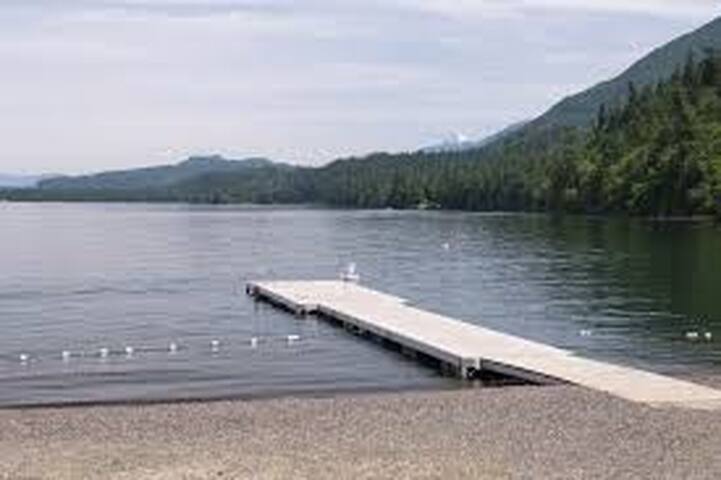
Shawnigan Lake is a beautiful 7km long stretch of water offering everything you could possibly want from a lake adventure! This family-friendly destination has multiple sandy beaches from which you can take a dip!
49 Einheimische empfehlen
Shawnigan Lake
22 min (21.8 km) via Shawnigan Lake Rd
Shawnigan Lake is a beautiful 7km long stretch of water offering everything you could possibly want from a lake adventure! This family-friendly destination has multiple sandy beaches from which you can take a dip!
27 min (28.1 km) via Trans-Canada Hwy/BC-1 S
If you’re looking for a family-friendly swimming spot, this is a great spot. This lake has lots of grassy areas for children to play. Much of the lakeside property has been claimed by private residence but there are 4 public access points to the lake: Whitehead Park; Estelline Park; South Prospect Lake Park; and Echo Place Boat Launch.
Prospect Lake
27 min (28.1 km) via Trans-Canada Hwy/BC-1 S
If you’re looking for a family-friendly swimming spot, this is a great spot. This lake has lots of grassy areas for children to play. Much of the lakeside property has been claimed by private residence but there are 4 public access points to the lake: Whitehead Park; Estelline Park; South Prospect Lake Park; and Echo Place Boat Launch.
31 min (30.4 km) via Trans-Canada Hwy/BC-1 S
Eagles Lake is SMALL and often crowded with young children. However, since the lake is so tiny it warms quickly in the sun and can provide some of the warmest swimming around Victoria. If you are the type of person who doesn't mind swimming on an overcast day, Eagles can be a great spot as it is generally quieter and still quite warm!
Eagles Lake
31 min (30.4 km) via Trans-Canada Hwy/BC-1 S
Eagles Lake is SMALL and often crowded with young children. However, since the lake is so tiny it warms quickly in the sun and can provide some of the warmest swimming around Victoria. If you are the type of person who doesn't mind swimming on an overcast day, Eagles can be a great spot as it is generally quieter and still quite warm!
35 min (32.5 km) via Trans-Canada Hwy/BC-1 S
This lake has it all. Sandy beaches, hiking trails, playgrounds, washroom facilities, great fishing opportunities… you name it! Elk Lake lies to the north of Beaver Lake but they are really just one lake as they are connected by a narrow channel of water. Both Elk and Beaver have sandy beaches, and great swimming access.
43 Einheimische empfehlen
Elk Lake
35 min (32.5 km) via Trans-Canada Hwy/BC-1 S
This lake has it all. Sandy beaches, hiking trails, playgrounds, washroom facilities, great fishing opportunities… you name it! Elk Lake lies to the north of Beaver Lake but they are really just one lake as they are connected by a narrow channel of water. Both Elk and Beaver have sandy beaches, and great swimming access.
35 min (24.7 km) via Trans-Canada Hwy/BC-1 S
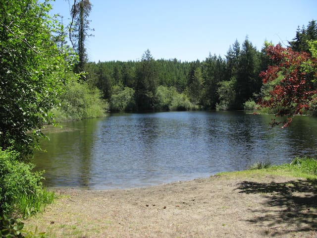
Durrance is quite small but does have some sandy spots along the water located on the north-eastern portion of the lake. There is also a small fenced dock at the northern tip of the lake but this is more for fishing than swimming. The 1.7km walking loop around the lake also has lots of water access from which you can take a dip! Note that in summer months, the small parkade at the lake does fill up quickly and you may have to park along Willis Point Road and walk to the lake. On a hot day, this is a great way to work up a sweat before hopping into the cool water!
27 Einheimische empfehlen
Durrance Lake
35 min (24.7 km) via Trans-Canada Hwy/BC-1 S
Durrance is quite small but does have some sandy spots along the water located on the north-eastern portion of the lake. There is also a small fenced dock at the northern tip of the lake but this is more for fishing than swimming. The 1.7km walking loop around the lake also has lots of water access from which you can take a dip! Note that in summer months, the small parkade at the lake does fill up quickly and you may have to park along Willis Point Road and walk to the lake. On a hot day, this is a great way to work up a sweat before hopping into the cool water!
36 min (33.1 km) via Trans-Canada Hwy/BC-1 S
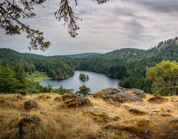
Similar to Elk Lake, there is nothing you can’t find at this lake. The swimming is sublime and there is a sandy beach to relax on. There is a 3.8km trail which loops around the lake that offers a hike of moderate difficulty (there are some rocky/steep portions along the western portion of the trail). There is also a small island in the middle of the lake that you can float to (or swim to if you’re comfortable doing so).
48 Einheimische empfehlen
Matheson Lake Regional Park
Matheson Lake Park Road36 min (33.1 km) via Trans-Canada Hwy/BC-1 S
Similar to Elk Lake, there is nothing you can’t find at this lake. The swimming is sublime and there is a sandy beach to relax on. There is a 3.8km trail which loops around the lake that offers a hike of moderate difficulty (there are some rocky/steep portions along the western portion of the trail). There is also a small island in the middle of the lake that you can float to (or swim to if you’re comfortable doing so).
38 min (43.8 km) via Trans-Canada Hwy/BC-1 N
There’s a reason why the hamlet of Maple Bay is home to both a yacht and rowing club: it’s because it has calm waters and it provides an idyllic panorama view of Salt Spring Island. Swimming and beach combing is possible all along the pebbled foreshore and at the northern end is a public park with a floating jetty and picnic tables.
16 Einheimische empfehlen
Maple Bay
38 min (43.8 km) via Trans-Canada Hwy/BC-1 N
There’s a reason why the hamlet of Maple Bay is home to both a yacht and rowing club: it’s because it has calm waters and it provides an idyllic panorama view of Salt Spring Island. Swimming and beach combing is possible all along the pebbled foreshore and at the northern end is a public park with a floating jetty and picnic tables.
42 min (39.3 km) via Trans-Canada Hwy/BC-1 S and Juan De Fuca Hwy/Sooke Rd/BC-14 W
The Sooke Potholes are a swimmer’s paradise. The deep pools and unique rock formations are the result of glacial activity from the end of the last ice age some 13 million years ago!
There are some really stunning places to explore along the river but access can be steep and quite perilous in some places. Stay within the limits of your comfort zone and watch out for slippery rocks along the riverside. The potholes make for great snorkeling and there are underwater caves and structures to be explored. There is also a 67-site first come, first serve campground (no reservations) located at the northern end of Sooke Potholes Provincial Park. Admission is $25/ night (CASH ONLY) and they have firewood for sale. **It is worth noting that all three parking lots Sooke Provincial Park are paid parking and patrolled regularly.
222 Einheimische empfehlen
Sooke Potholes Provincial Park
Sooke River Road42 min (39.3 km) via Trans-Canada Hwy/BC-1 S and Juan De Fuca Hwy/Sooke Rd/BC-14 W
The Sooke Potholes are a swimmer’s paradise. The deep pools and unique rock formations are the result of glacial activity from the end of the last ice age some 13 million years ago!
There are some really stunning places to explore along the river but access can be steep and quite perilous in some places. Stay within the limits of your comfort zone and watch out for slippery rocks along the riverside. The potholes make for great snorkeling and there are underwater caves and structures to be explored. There is also a 67-site first come, first serve campground (no reservations) located at the northern end of Sooke Potholes Provincial Park. Admission is $25/ night (CASH ONLY) and they have firewood for sale. **It is worth noting that all three parking lots Sooke Provincial Park are paid parking and patrolled regularly.
44 min (54.1 km) via Trans-Canada Hwy/BC-1 N
Just 920 metres long, it’s among Cowichan’s smaller lakes – but no less of a playground. Here you can enjoy a number of activities including sand castle building at the sandy beach, swimming to the floating pier, (lifeguards are on duty during the summer) kayaking, tennis and pickleball. There’s even an aluminum dock from which you can cast for trout or bass. The grassy lawn above the beach is a great place for picnics.
10 Einheimische empfehlen
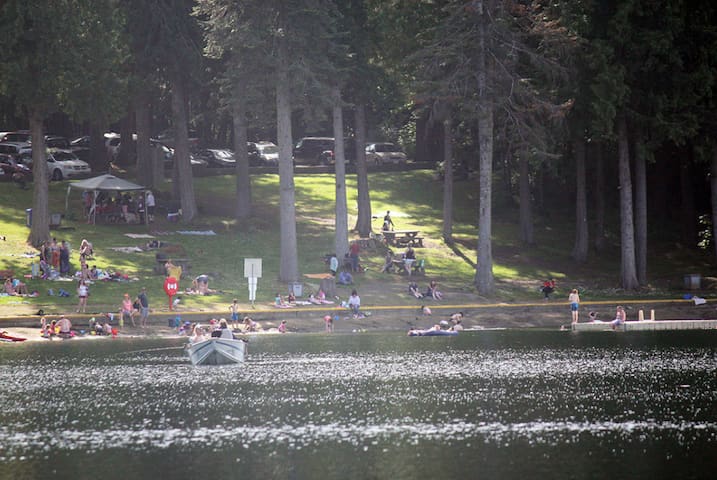
Fuller Lake Park
9323 Poplar Rd44 min (54.1 km) via Trans-Canada Hwy/BC-1 N
Just 920 metres long, it’s among Cowichan’s smaller lakes – but no less of a playground. Here you can enjoy a number of activities including sand castle building at the sandy beach, swimming to the floating pier, (lifeguards are on duty during the summer) kayaking, tennis and pickleball. There’s even an aluminum dock from which you can cast for trout or bass. The grassy lawn above the beach is a great place for picnics.
52 min (66.0 km) via Trans-Canada Hwy/BC-1 N
Named for the original “transfer slip” used to transfer loaded rail-cars from ships to shore at the turn of the century, “Transfer Beach” is now an expansive and scenic ocean side park. Yes, you can go swimming here, but there’s much more you can do too. You can rent a kayak, toss a Frisbee around, play beach volleyball or simply enjoy a picnic with a million dollar view. You can even take in a concert on summer Sunday evenings at the park’s amphitheater. Perhaps the park’s biggest draw is the elaborate kids’ playground featuring a wonderfully wet spray park.
40 Einheimische empfehlen
Transfer Beach Park
Captain Tristan de Konnick Way52 min (66.0 km) via Trans-Canada Hwy/BC-1 N
Named for the original “transfer slip” used to transfer loaded rail-cars from ships to shore at the turn of the century, “Transfer Beach” is now an expansive and scenic ocean side park. Yes, you can go swimming here, but there’s much more you can do too. You can rent a kayak, toss a Frisbee around, play beach volleyball or simply enjoy a picnic with a million dollar view. You can even take in a concert on summer Sunday evenings at the park’s amphitheater. Perhaps the park’s biggest draw is the elaborate kids’ playground featuring a wonderfully wet spray park.
54 min (69.7 km) via Trans-Canada Hwy/BC-1 N and Cowichan Valley Hwy/BC-18 W
The Cowichan River extends 47 km from its source at Lake Cowichan to its mouth at Cowichan Bay. In the summer, the river is ideal for what is commonly known as “tubing”, a one-way nature trip in emerald green and (mostly) quiet waters aboard inflated inner tubes. There are many options on where to start or end the trip and there are numerous businesses that will outfit and shuttle you.
40 Einheimische empfehlen
Lake Cowichan Fluss Tubing
109 S Shore Rd54 min (69.7 km) via Trans-Canada Hwy/BC-1 N and Cowichan Valley Hwy/BC-18 W
The Cowichan River extends 47 km from its source at Lake Cowichan to its mouth at Cowichan Bay. In the summer, the river is ideal for what is commonly known as “tubing”, a one-way nature trip in emerald green and (mostly) quiet waters aboard inflated inner tubes. There are many options on where to start or end the trip and there are numerous businesses that will outfit and shuttle you.
1 hr 5 min (82.8 km) via Trans-Canada Hwy/BC-1 N and Cowichan Valley Hwy/BC-18 W
Located on the other side of Lake Cowichan in the town of Youbou is Arbutus Park, a hidden gem of a swimming spot. The park features a floating jetty with a slide, a sandy beach and a grassy area, complete with picnic tables. As Arbutus Park is south facing, the rays of the sun reflecting off the water can be intense, so be sure to bring sunscreen!
12 Einheimische empfehlen
Arbutus Park
Alder Crescent1 hr 5 min (82.8 km) via Trans-Canada Hwy/BC-1 N and Cowichan Valley Hwy/BC-18 W
Located on the other side of Lake Cowichan in the town of Youbou is Arbutus Park, a hidden gem of a swimming spot. The park features a floating jetty with a slide, a sandy beach and a grassy area, complete with picnic tables. As Arbutus Park is south facing, the rays of the sun reflecting off the water can be intense, so be sure to bring sunscreen!
1 hr 8 min (84.2 km) via Trans-Canada Hwy/BC-1 N
When it comes to swimming holes, the Nanaimo River offers some of the Island’s best. With incredible smooth rock formations shaped over thousands of years and deep pools perfect for summer dips, this river system is one of the best spots to cool off in the summer months. Swimming, rock jumping, sunbathing, and snorkeling can all be done here.
There are countless places to swim along the river. As a general rule of thumb, you can simply drive along Nanaimo River Road and look for parked cars along the road. Find a place to pull in and follow the trail head down towards the river.
The following are 3 spots along the river that will not disappoint:
1- “Cedar Bridge” - this is one of the more family friendly areas along the river. It is also one of the easiest to access.
2- “The Power Lines” - this breathtaking spot gets its name from the power lines which hang above this section of the river. The rock formations are unreal and the swimming is sublime. TAKE NOTE: the trail down from the road takes about 15 minutes to walk and becomes incredibly steep as you get closer to the river. As a result, this area is not well suited for children or individuals that have mobility issues.
3- “The Trestle” - the foundation of an old trestle can be found along the river and has become a popular spot for swimming. This spot, like the “Power Lines” is usually populated with younger crowds and is not recommended for small children.
13 Einheimische empfehlen
Nanaimo River
1 hr 8 min (84.2 km) via Trans-Canada Hwy/BC-1 N
When it comes to swimming holes, the Nanaimo River offers some of the Island’s best. With incredible smooth rock formations shaped over thousands of years and deep pools perfect for summer dips, this river system is one of the best spots to cool off in the summer months. Swimming, rock jumping, sunbathing, and snorkeling can all be done here.
There are countless places to swim along the river. As a general rule of thumb, you can simply drive along Nanaimo River Road and look for parked cars along the road. Find a place to pull in and follow the trail head down towards the river.
The following are 3 spots along the river that will not disappoint:
1- “Cedar Bridge” - this is one of the more family friendly areas along the river. It is also one of the easiest to access.
2- “The Power Lines” - this breathtaking spot gets its name from the power lines which hang above this section of the river. The rock formations are unreal and the swimming is sublime. TAKE NOTE: the trail down from the road takes about 15 minutes to walk and becomes incredibly steep as you get closer to the river. As a result, this area is not well suited for children or individuals that have mobility issues.
3- “The Trestle” - the foundation of an old trestle can be found along the river and has become a popular spot for swimming. This spot, like the “Power Lines” is usually populated with younger crowds and is not recommended for small children.
1 hr 10 min (83.2 km) via Trans-Canada Hwy/BC-1 N and Cowichan Valley Hwy/BC-18 W
Not only is Gordon Bay a great place to camp, it also provides a sprawling sandy beach which makes for great beach-combing and swimming. Day trips are welcome (you don’t need to be a camper) and there’s plenty of parking too.
9 Einheimische empfehlen
Gordon Bay Provincial Park
7370 Walton Road
1 hr 10 min (83.2 km) via Trans-Canada Hwy/BC-1 N and Cowichan Valley Hwy/BC-18 W
Not only is Gordon Bay a great place to camp, it also provides a sprawling sandy beach which makes for great beach-combing and swimming. Day trips are welcome (you don’t need to be a camper) and there’s plenty of parking too.