Park
PR1.2 Vereda do Pico Ruivo
Von 13 Einheimischen empfohlen,
Tipps von Einheimischen

Cristina
August 27, 2020
Walk between the two highest peaks of Madeira

João Marcelino
June 7, 2022
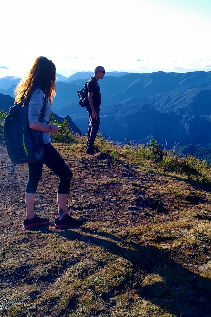
Begining at Achada do Teixeira this trail climbs up to the island´s highest peak, Pico Ruivo (1862m) and it´s one of those places you can´t miss. It´s about 2,8km and it takes about 1h30 if you go slowly.

Rui
October 17, 2017
A 6Km round-up trail that starts at Achada do Teixeira and ends on the highest peak of Madeira Island, this easy terrain but phisically demanding path will make the day for many hikers. Filled with amazing landscapes of mountains and valleys, it is simply one that you can't miss while staying at the cottages!

Cláudia
June 5, 2022
Beginning at Achada do Teixeira this trail climbs up to the island’s highest peak, Pico Ruivo (1862 m) and it's one of those places you can't miss. It´s about 2,8km and it takes about 1h30 if you go slowly.

Bernice
May 25, 2021
This trail of 2,8km and duration of 1.30 hours allows you to get to the highest summit of the island, Pico Ruivo. Beginning at Achada do Teixeira this trail climbs up to the island’s highest peak, Pico Ruivo (1862 m). Next to the Pico Ruivo government house you can gain access to 3 other trails that take the hiker to different parts of the island: PR 1 - Pico do Areeiro footpath (5,1/6,4 Km), which takes you to Pico do Areeiro, the island’s 2nd highest peak (1816m); PR 1.3 - Encumeada Footpath (8.6 Km), goes along the central mountain range to the West; and PR 1.1- Ilha Footpath (8.2 Km), which descends to the parish of Ilha. Along the climb you will meet several shelters as the change in climate is sudden and sharp and the area often becomes covered in a sea of clouds or rests above it. This area is part of the European network of important areas - Natura 2000 - and is known as the central mountain massif. It covers from the highest peaks to 1200m above sea level. It is characterised by herbaceous and bush vegetation that is well-adapted to big temperature variations, heavy rains and strong winds, and is where you can find many types of heather (Erica scoparia ssp maderensis and Erica aborea), which many years ago were used to produce charcoal. The trail climbs along the ridge that separates the cliffs of Faial and those of Santana, and so allows for an excellent view to the left of the Ribeira Seca valley, topped by Pico das Torres, and Pico do Areeiro in the background. On the right-hand side you can see the “gables” of the Santana mountain range, from where in the distance you can see the Queimadas Forest Park and further ahead Achada do Marques (a small hamlet known for its straw lofts and traditional fields), which appears in the centre of the Ribeira dos Arcos valley. T owards the interior we can see the Ribeira Grande valley that begins at the “mouths” of Caldeirão Verde and Caldeirão do Inferno. When visibility is good to the East you can see the rocky outcrop of Penha d’Águia, the Funduras mountain range and part of the S. Lourenço Point (far eastern part of Madeira island). At Achada do Teixeira you can also visit the “Standing Man” (“Homem em pé”), a basalt formation which you will find walking down the cliff, after passing the Achada do Teixeira government house.
This trail of 2,8km and duration of 1.30 hours allows you to get to the highest summit of the island, Pico Ruivo. Beginning at Achada do Teixeira this trail climbs up to the island’s highest peak, Pico Ruivo (1862 m). Next to the Pico Ruivo government house you can gain access to 3 other trails tha…
Einzigartige Aktivitäten in der Umgebung
Das empfehlen Einheimische
Standort
Achada do Teixeira
Santana, Madeira